Report on the impact, use and updating of the Standards and Related Texts of the Codex Alimentarius in the Current National and Regional Technical Regulations
Keywords:
Remote sensing, CHIRPS, satellite precipitation, monthly accumulated rainfall, El Salvador , R applicationsAbstract
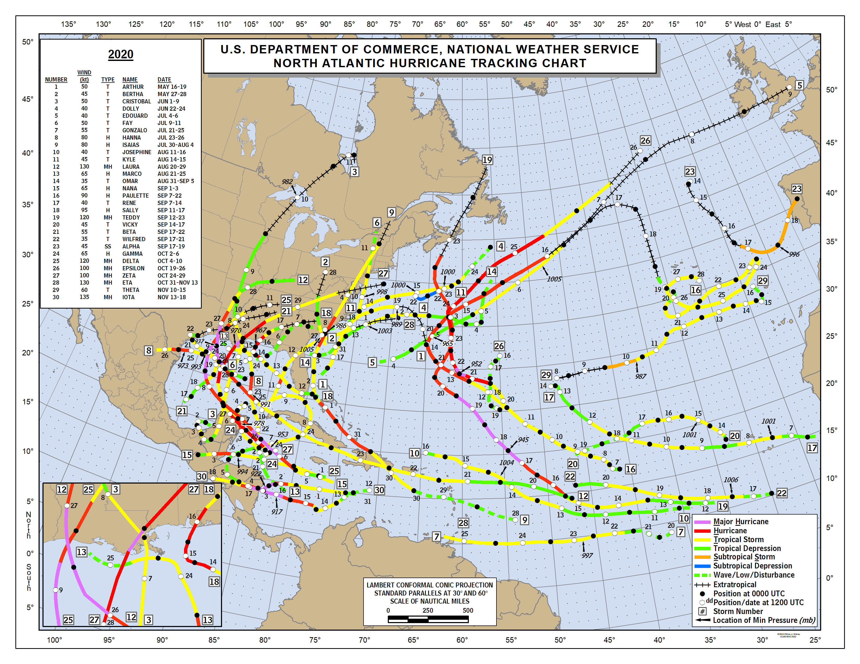
ThisThe Climate Hazards Group’s Estimated Preci-pitation Products from Satellite and Rainfall Stations (CHIRPS), developed in collaboration with USGS, NASA, NOAA and FEWS NET, are useful for mo-nitoring precipitation accumulation and providing better risk management in areas susceptible to lands-lides, floods and droughts. In this study, considering the influence of the Atlantic and Pacific hurricane season, the estimated precipitation data from satellite images were analyzed to generate twelve accumulated monthly precipitation maps for the year 2020 in El Salvador using the statistical software R. In general, the month of maximum accumulated precipitation was June, impacted by Tropical Storms Amanda and Cristobal, reaching 900 mm of precipitation; followed by October (800 mm), influenced by both Hurricane Gamma and Delta; and September (475 mm), related to Hurricane Nana. The month of mi-nimum accumulated precipitation was January (0-1 mm), followed by February, March and December. The region that received the highest monthly accu-mulated precipitation was Chalatenango, while the least was Usulután.
Downloads
References
CENTRO DE METEOROLOGÍA E HI-DROLOGÍA. 1993. Almanaque Salvadoreño. San Salvador, Dirección General de Recursos Naturales del Ministerio de Agricultura y Ganadería de El Sal-vador. 4 p.MARN. 2017. Informe Nacional de Riesgos y Vulnerabilidades. San Salvador, Ministerio de Medio Ambiente y Recursos Naturales de El Salvador. pp. 60-71.
MARN. 2012. Caracterización de condiciones meteorológicas. San Salvador, Ministerio de Me-dio Ambiente y Recursos Naturales. Disponible en: http://rcc.marn.gob.sv/handle/123456789/228 NHC: 2020 ATLANTIC HURRICANE SEA-SON [INTERNET]. 2020. 2020 North Atlantic Hurricane Season Track Map. Disponible en: https://www.nhc.noaa.gov/data/tracks/tracks-at-2020.png
UN OFFICE FOR THE COORDINATION OF HUMANITARIAN AFFAIRS. 2020. El Salvador - Panorama de Impacto: Tormenta tropical Amanda y tormenta tropical Cristóbal. San Salvador: OCHA.
UN OFFICE FOR THE COORDINATION OF HUMANITARIAN AFFAIRS. 2020. El Salva-dor: Emergencia Huracán IOTA - Informe de Situ-ación No. 01. San Salvador: OCHA.UN OFFICE FOR THE COORDINATION OF HUMANITARIAN AFFAIRS. 2020. El Salva-dor: Emergencia Tormenta Tropical ETA - Informe de situación No. 01. San Salvador: OCHA.

Downloads
Published
How to Cite
Issue
Section
License
Copyright (c) 2022 Izote Journal

This work is licensed under a Creative Commons Attribution-NonCommercial 4.0 International License.


